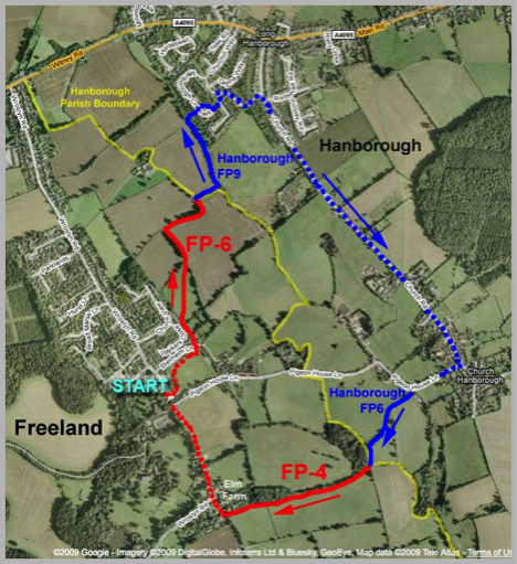
Freeland – Long Hanborough – Church Hanborough – Freeland
Distance 3 miles
This is a gentle walk starting and finishing at the car park of the Village Hall. The course is over the fields to Long Hanborough then along the road to Church Hanborough and back over the fields to Freeland by way of the Village Green.
Although half the route is on roads only a few yards in Church Hanborough and a short length of Pigeon House Lane are without footpaths. The longest section of road from Long to Church Hanborough has a good footpath set away from the carriageway.
The walk starts by crossing the playing field to the far left corner, avoiding the cricket square on the way. This field is marked on old maps as ‘The Bretch’ I believe this is from the Anglo Saxon and means ‘land newly taken into cultivation, often from bracken covered land’.
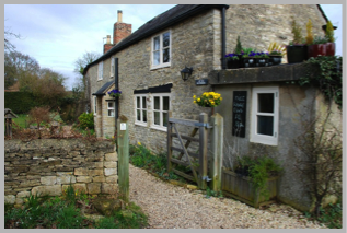
Beyond the field you will emerge into Blenheim Lane opposite the old cottage ‘Little Blenheim’ with its sign for Free Range Eggs.
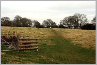
Go through the gate and pass directly in front of the cottage, at the far side you will find a narrow passage between a hedge and a fence leading to a swing gate giving access to the field.
The footpath goes forward keeping the field boundary on the left for 50yds or so until you come level with a metal gate. This gate provides the athletic with an alternative but unofficial route from Church Lane/Walkers Close.
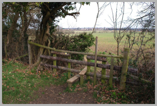
At this point the path heads off diagonally to the far corner of the field where you will find a stile with two steps and a handy post to hang on to. This is the only stile between Freeland and Long Hanborough.
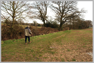
On the other side the path turns sharp left and follows the field boundary to the corner where you turn right. The path here is well marked and easy to follow keeping the hedge and ditch on your left.
It is worth mentioning that some older maps show the path crossing the fields diagonally, however it was officially diverted some years ago and now follows the headlands.
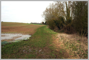
Eventually after a further left and right turn you arrive at the brook and the hedge ends. (this is the end of Freeland footpath FP6 and the start of Hanborough FP9) The path turns left over some ground that can be soft in wet weather and then heads north with the brook on your right.
Note: Yellow Flag Irises can be found near here from May to September - See notes by Martin Marais.
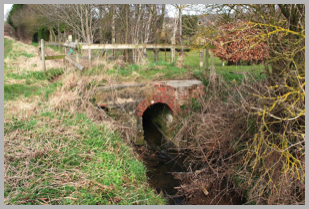
After 200 yds you will find this rather well built bridge. Obviously this once carried a track from Hanborough towards Cooks Corner Farm. Although the footpath appears to continue straight ahead the official route crosses the bridge and then turns immediately left.

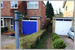
The path passes between the gardens and the stream and continues for 175 yds until it turns sharp right and passes between the houses to reach Marlborough Crescent.
The footpath emerges between Nos. 23 and 21 on Marlborough Crescent.
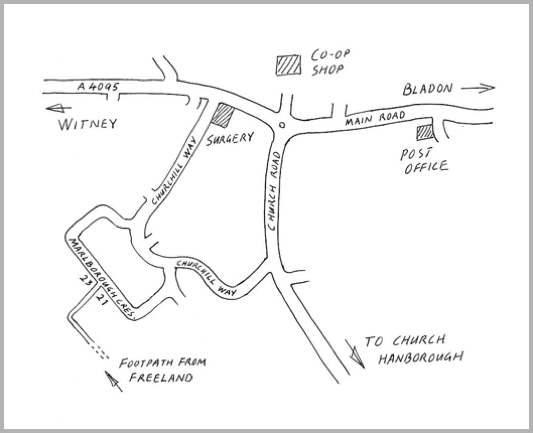
Turn right and follow the road round to Churchill Way.
Turn Right again and follow the road to Church Road where you turn right to Church Hanborough.
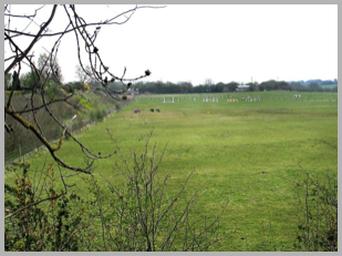
Just before joining Church Road there is a good view south to Church Hanborough across some paddocks. The flatness of the fields here is due to the ground being restored after extensive gravel workings in the late 19th early 20th centuries along what was a terrace of river gravel. Geologically it is known as the ‘Hanborough Terrace’ and is the highest river terrace in the Upper Thames system.
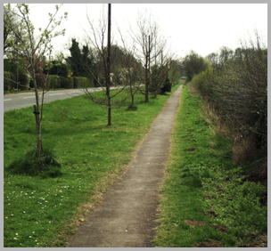
The route from Long to Church Hanborough is by way of a good surfaced footpath well away from the carriageway. The approach to Church Hanborough is particularly pleasant.
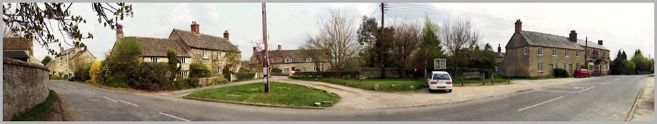
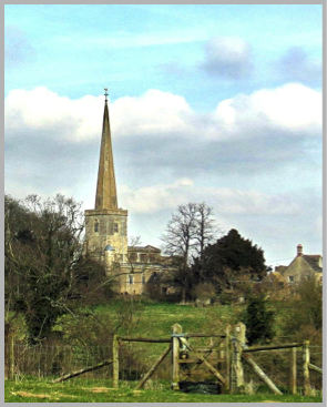
Panoramic view of Church Hanborough with the Hand & Shears on the right
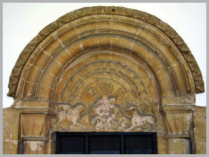
The north doorway, has this charming tympanum showing St. Peter with a lion and the lamb of God.
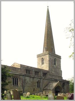
Time perhaps for a break! This very pretty village clusters around the early 12th century church of St. Peter and St. Paul which although extensively remodelled over the years still retains some original Norman features. The spire, a landmark for miles around was added about 1400.

Unfortunately the original south doorway, although still visible internally, has become the boiler room!
Our walk now continues south past the Hand & Shears and then turns right opposite the old post office into Pigeon House Lane.
The lane, which is narrow but has little traffic, descends a steep bank and then turns right.
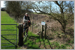
At this bend, turn left towards what look like poly-tunnels but are actually sheep pens. The footpath gate will be found on the right after a few steps.
Head uphill (on Hanborough footpath FP6) and you will soon see the next gate.
From here there is a fine view of Church Hanborough.
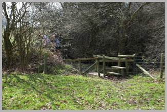
Now head obliquely to your left passing into the next field then downhill to find this small bridge and two stiles in the corner of the field.
Once over the second stile follow the path keeping to the side of the field alongside the wood. You are now back in Freeland on footpath FP4.
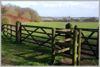
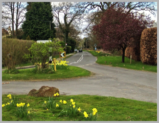
Eventually after passing through a further gate you will reach the Village Green.
It is worth pausing for a moment to look back and admire the view. This area is the old heart of the village and the wood on the left which is now called The Thrift was formally called The Frith, an Anglo Saxon word having the meanings of peace, sanctuary or woodland. This gives us our village name as Frithland became Freeland.
The last lap!
From the Green back to the Village Hall.
© Martin Shann & Peter Newell 2009